December 15, 2016
Francisco Fontseca
The visibility of a Drone.
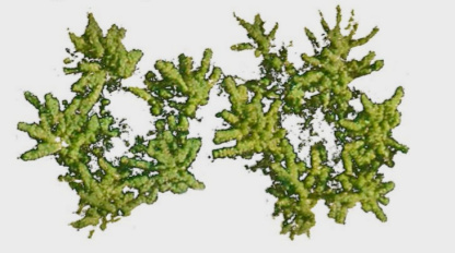
One of the alternative ways of examining changes in the aerial part of a crop during its cycle is through the measurements of the fraction of soil covered by crop vegetation, which is closely related to the canopy leaf area.

One of the alternative ways of examining changes in the aerial part of a crop during its cycle is through the measurements of the fraction of soil covered by crop vegetation, which is closely related to the canopy leaf area. Knowing the status and the condition of the leaf area development and its revolution over time is a fundamental information, since it is a useful variable to characterize and evaluate the development and the growth of crops in studies of fertility, productivity, water requirements... It also helps evaluate the density and the biomass of vegetation cover, as well as the response of plants to the environmental conditions or different crop management strategies.
The most common method for determining the soil fraction covered by crop vegetation is manually: they measure the diameter of the cup in several directions, they take an average, and they assume the cup to be circular, which is not really true, which in practice it is an imprecise determination with a remarkably low and unrepresentative population. That is to say, for the realization of rigorous studies whether scientific or commercial, it is not, for the moment, an acceptable method.
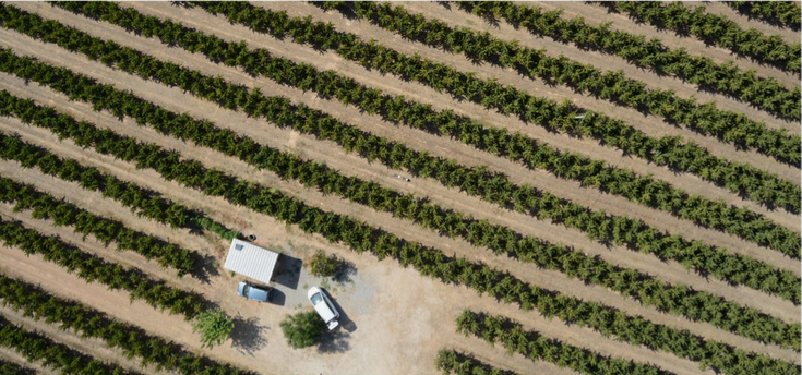
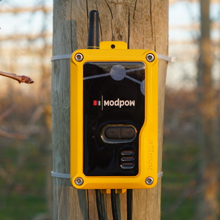
During the last decades, traditional photography has evolved into digital photography, leading to the development of a wide range of electronic light sensors. Although the digital technology was initially expensive, it is now very affordable. Digital camera sensors convert light into digital information, which can then be processed and analyzed with the help of image analysis programs for more information. Currently, there are very compact and lightweight cameras with high image quality on the market that can be shipped on unmanned aerial vehicles (UAVs, or drones).The acquisition of images with the help of the VANT allows to obtain a wide spatial coverage, which increases the representativeness against other methods, besides obtaining a high resolution of image, with pixel sizes of up to 2cm. This high resolution allows quantitative measurements of any particularity or area of interest of cultivation in a practically direct way.
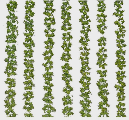
In 2015, J. Lordan (engineer of AKIS) and colleagues published a study in the journal of the American Society of Horticultural Sciences in which they developed a new method of image analysis of fruit trees with which they could determine with great precision the Vegetative growth of trees1. Recently AKIS has participated together with other institutions in an agricultural remote sensing project2, in which new diagnostic methods have been developed. As part of this project and based on the work published by J. Lordan, a new method was recently developed with the objective of determining the soil cover of many trees at the same time, with high resolution and precision, using images In visible color obtained with a UAV. The results obtained, shown in the figure, indicate that this technique can be an important tool for the determination, characterization and modeling of vegetative structures not only at the individual level, but also at the farm or plot level, increasing by Consequently the representativeness of the method and making it an instrument with a high potential of use, not only in scientific studies but also at the professional agricultural level.
1Esta publicación fue galardonada recientemente como la mejor publicación del 2015 por la Sociedad Americana de Ciencias Hortícolas.
2Proyecto co-tutorado por F. Fonseca y realizado en colaboración con la Universidad de Barcelona, Agromapping y Mdrone.